.png)

Compare 1852 & 1876 Plans
The 1852 Local Board of Health Plans and Ordnance Survey 1876 Plans can be compared with each other or else to a modern map. Search for a particular modern place, then explore by moving around and zooming. This handy PDF with the Evolution of Street Names in the Altrincham Area can be downloaded.
When you click on an 1852 Plot, the 1852 Plans Data appears for each of one of them. It comes from the ‘Altrincham Survey. Book of Reference. 1852.’ of which you can download the PDF with all 1,666 Plot transcriptions.
Where they exist, images of buildings in place by 1852 will also appear. Plot numbers are described clockwise starting from the left. Brackets around Plot numbers indicate there is a better image nearby. Tick the Images box to find them.
Particular names, places or topics, can be found in this searchable PDF Compare 1852 & 1876 Plans: Extended Captions.
There is a Key to both Plans at the bottom of the page. For more information visit the Background and also see the Whole 1852 and 1876 Plans page.
 IMAGES
|
KEY to the ‘Detail Plans of the Township of Altrincham Surveyed for the Purposes of the Local Board of Health 1852’, by Charles E. Cawley M.I.C.E, Manchester. Scale 1:528 or 10 Feet to a Mile. Watercolour and ink on paper, 15 sheets. Digitised by courtesy of Trafford Local Studies Centre in Sale, Cheshire (ALT/9/1/1/1). |
KEY to the Ordnance Survey of England, Cheshire: Plans of Altrincham, surveyed 1876 (published 1878), Southampton. Scale 1:500 or 10.56 Feet to a Mile. Zincograph on paper. 24 sheets.
© The British Library Board (Maps O.S.T. (9), Ordnance Plan of the Town of Altrincham). |
|---|---|
| T B.M. Bench Mark. The Levels are given from a Datum 52 feet below the Bench Mark on the Broadheath Bridge |  B.M. Bench Mark B.M. Bench Mark |
| C.H. Coach House | B.S. Boundary Stone |
| C.N Cistern Overhead [holding water] | D.B. Dust Bin |
| C.N Cistern Sunk [holding water] | F.P. Fire Plug |
| CO.H. Cow House | G.P. Gas Plug or Guide Post (sign post) |
| C.P. Cess Pool [hole of dirty water or sewage] | M.H. Man Hole |
| G.H. Green House | L. Lamp |
| K.S. Kitchen Sink [sometimes outside] | L. Lamp Post |
| L. Lamp | P. Pump |
| L.P. Lamp-Post | P.H. Public House |
| R.S. Rain Spout | S.D. Sun Dial |
| S. Sink Stone [stone slab over a pit of small stones for effluent to flow down] | S.H. Summer House |
| S.G. Sewer Grates | S.P. Signal Post |
| S.T. Stable | T.k Tank |
| o Privy [or ‘necessary’, a dry toilet whereby waste is collected regularly] | T. Trough |
| W.C. Water Closet [whereby waste is flushed and flows into sewers] | W.M. Weighing Machine |
| W.C. Water Closet Overhead [with a cistern] | W.P. Water Plug |
| W.C. Water Closet Sunk | See further Ordnance Survey abbreviations. |
| W.H. Wash House | |
Bricks Houses and Buildings  |
|
Wood Buildings and Sheds 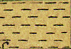 |
|
Stone Paving and Flagging  |
|
Macdam or Ballast  |
|
Garden Ground 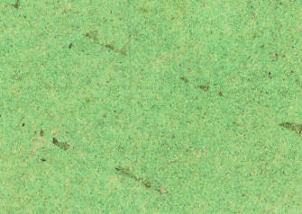 |
|
Green house 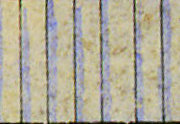 |