.png)

Extra Maps & Plans
The PDFs of these maps and plans can be zoomed and explored in detail once downloaded. They are in date order, with the oldest first.
To the right is an image reflecting the time each map or plan was surveyed, which can be enlarged for more information and the images associated with the others can be browsed from there.
This selection has been scanned or photographed with the generous agreement of local collectors or institutions.
Here is a handy PDF showing the Evolution of Street Names in the Altrincham Area (1.2 MB). To see more maps and plans which are available on the internet, please visit the Useful Links. In particular, the Cheshire Tithe Maps website is very informative.

‘[Altrincham] in the County Palatine of Chester. Property of the Right Honourable George Harry Earl of Stamford 1790’ (1790 with additions c. 1799)
Ink and colour wash on vellum by William Crosley. Scale 3 ½ chains to the inch (1 chain = 66 feet).
The Stamford Altrincham Property Plan roughly covering the area of the Township of Altrincham, depicts buildings, roads, paths, fields, water features and hedges in some detail. The tenants or owners of some fields and parcels of land are recorded, but most are identified only by a number. No schedule appears to have survived to identify these numbers.
Please see Altrincham in 1799 by Don Bayliss (c.1995) in the Local History Publications for a fuller description. The Plan has been kindly reproduced with permission from The National Trust and John Rylands Library, University of Manchester (GB 133 EGR11/5/11). Please contact the House and Collections Manager at Dunham Massey Hall and John Rylands Library, should you wish to reproduce this Plan.


Annotated ‘[Altrincham] in the County Palatine of Chester. Property of the Right Honourable George Harry Earl of Stamford 1790’ (1790 with additions c.1799).
Ink and colour wash on vellum by William Crosley. Scale 3 ½ chains to the inch (1 chain = 66 feet).
For a fuller description, see above, along with Altrincham in 1799 by Don Bayliss (c.1995) in the Local History Publications. Due to the distortion in the depiction of the roads and features, it was not practical to include the Stamford Plan on the Interactive Plans page and match it to a modern map or the other Plans. Instead, here is a version marked with key locations and features to help with navigation. The Plan has been kindly reproduced with permission from The National Trust and John Rylands Library, University of Manchester (GB 133 EGR11/5/11). Please contact the House and Collections Manager at Dunham Massey Hall and John Rylands Library, should you wish to reproduce this Plan.

‘Parish of Bowdon in 1800 shewing places of worship then existing in the parish (Townships in Domesday Book shaded)’ (1923)
Photograph of a map in a booklet Ringway Chapel before the Disruption 1515-1721: An Historical Review with an Explanatory Map by Alfred Tarbolton, Mackie & Company Ltd, Altrincham, 1923
In 1800, the parish of Bowdon covered an extensive area but by 1911, seventeen new parishes had been carved out of it, all but one since 1852, reflecting the rapid rise in population. See the Guide to Bowdon Parish Church and the Surrounding Area on the Local History Publications page.


Field Names on Altrincham, Bowdon, Hale, Timperley, Dunham Massey and Warburton Tithe Maps and Plans 1835-40, David Miller 2012-17
DOWNLOAD searchable PDF (1.2 MB)
David Miller presents the field names from the Maps and Plans in an easy-to-read format. To see the originals and for more information see the Cheshire Tithe Maps from Cheshire Archives.


Altrincham, Bowdon and the wider surrounding area, including Carrington, Irlam, Flixton, Ringway, Mobberley and Knutsford (detail) (1843 and 1872)
Ordnance Map Office, London, published by Colonel Colby on 2nd January 1843. Scale 1 inch to one Statute Mile.
The base map depicts the area just before it was published in 1843, for example, not shown are East Downs Road (with land for it sold in 1845); Bowdon Downs Congregational Church (completed in 1848) and St Margaret’s Church (completed by 1855). However, this is a later electrotype edition dating from 1872, which superimposes the train stations and railway lines which had been built since the original map had been made, for example the Manchester South Junction and Altrincham Railway in 1849, extended by the Cheshire Midland Railway in 1862.


Detail Plans of the Township of Altrincham Surveyed for the Purposes of the Local Board of Health, 1852, Sheet 6 (Market Place and lower George Street area) (1852)
Lithographic version with watercolour on paper by George Falkner, Manchester from the original Plan surveyed by Charles E. Cawley C.E., 1852. Scale 1:528 10 feet to one mile.
This lithographic Plan is from a set of 15 covering the area, with fifty sets in all being published to aid with the collecting of rates to improve the sanitation of the town. This set is held by Trafford Local Studies Centre (ALT/9/1/1/2), who along with the full set of original watercolour and ink Plans by Charles E. Cawley seen elsewhere on this web site, have kindly allowed scanning and reproduction for ease of access and digital conservation.


Warrington and Stockport Railway – Timperley Junction – Copy – Consent to alteration of level crossing, 29 December 1858
Ink and colour wash on paper by John Lister Engineer.
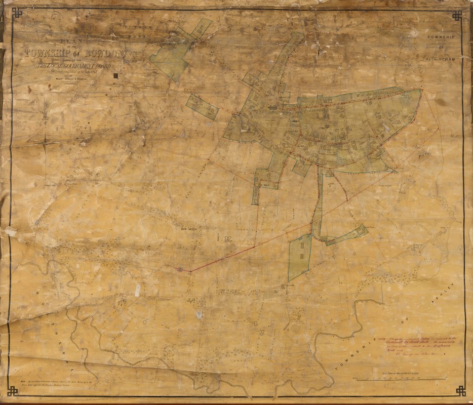
‘Plan of the Township of Bowdon surveyed for the Local Government Board in 1865 and completed up to July 1867’ (1865-67)
Lithograph (G. Falkner, Manchester) and ink and colour wash on velum by Charles E. Cawley and John Newton, civil engineers and surveyors. Scale 2 feet to one mile or 220 feet to one inch.
In the twenty years between the July 1845 Act of Parliament for the railway to run from Altrincham to Manchester and the commissioning of the Plan, the small rural village of Bowdon had become a desirable commuter suburb. The Plan was the response of the newly formed Bowdon Local Board, to assess the increase in demand on the limited water from springs, wells and pumps; the disposal of household and highway waste and the supply of gas from Altrincham for lighting. The new sewage system leading down to the Bollin river and gas lamps are shown on the Plan.
The Plan is held by Bowdon Parish Archives, who have kindly allowed it to be photographed by John Rylands Heritage Imaging.


Central & north Altrincham, with part of Oldfield Brow, Broadheath & Timperley (surveyed 1876, published 1882)
OS map Cheshire (Mid Division) Sheet XVIII.2, surveyed by Captain J. C. Macpherson. Scale 1:2,500.
This is a small scale, coloured version which was taken from the same survey as the 1:500 Altrincham Township Plan, undertaken in 1876 and published in 1878. It covers a much wider area but still gives a lot of detail.


West Altrincham & part of Bowdon & Dunham Massey (surveyed 1876, published 1882)
OS map Cheshire (Mid Division) Sheet XVIII.5, surveyed by Captain J. C. Macpherson. Scale 1:2,500.
This is a small scale, coloured version which was taken from the same survey as that of the 1 to 500 Altrincham Township Plan, undertaken in 1876 and published in 1878. It covers a much wider area but still gives a lot of detail.

Central Altrincham and part of Bowdon, Timperley and Hale (surveyed 1876, published 1882)
OS map Cheshire (Mid Division) Sheet XVIII.6, surveyed by Captain J. C. Macpherson. Scale 1:2,500.
This is a small scale, coloured version which was taken from the same survey as the 1:500 Altrincham Township Plan, undertaken in 1876 and published in 1878. It covers a much wider area but still gives a lot of detail.


Plan showing Altrincham & Bowdon Station with the layout of the new main and connecting roads (1876/1882)
From Altrincham Town’s Surveyors Department, overlaid on the OS Map published in 1882 (surveyed 1876), photographed and enhanced by courtesy of Norman Spilsbury. Scale 1 to 2,500.
The links from the newly combined Altrincham and Bowdon Station, along with the shopping and business street of Stamford New Road, up the already established George Street and up the hill beyond to the Old Market Place, were reinforced with the widening of Cross Street, along with the creation of Grafton Street to the south (left on the map) and Kingsway to the north (right on the map).


Geological Survey of England and Wales of North Cheshire (including Altrincham and environs) (1843-1888)
OS Base map NE (Northwich) no. LXXX published by Colonel Colby on 2nd January 1843. Overlays of Geological Information published 1861, Railways inserted to 1883 and Levels revised 1884. This is a new edition which was published in December 1888. Colour wash over an engraving. Scale one inch to one Statute Mile.
The large swathes of land around Altrincham consisting of dry, warm and easily workable sandy soil, indicated by the colours of the dark and also pale pink (Shirley Hill Sand), explain why market gardening was so successful. The soil had the added nutrients of night soil from the population of Manchester, brought by barges along the Bridgewater Canal. This gave rise to the Altrincham Carrot and the early crop of Bowdon Potato, which were in turn taken back by barge or cart to Manchester, to be recycled once again.

Sketch Map shewing the New Hale Urban District and its Environs: 1900 (1900)
Lithograph by J. Halden & Co, Manchester. Scale approximately ½ mile to an inch.
The map shows Rural Parishes, Urban Districts and Wards, along with key locations and buildings. It was made when the Urban District of Hale was formed in 1900, due to the growth in housing over the previous four decades, following the arrival of the Cheshire Midland Railway in 1862 and later extensions to Chester. In 1974, along with other Urban Districts, it became part of the Metropolitan Borough of Trafford in Greater Manchester.


Altrincham’s Historic Urban Grain: Medieval to 1900, Sue Nichols, 2015
The overlay was created for the Altrincham Town Centre Neighbourhood Business Plan 2015 to 2030. Graphics by courtesy of Mott Macdonald, Altrincham.


Environs of Altrincham (detail showing the area south of Manchester) (1910)
Roberts & Co, Nottingham. Scale half-an-Inch to one mile, with the map is divided into two mile squares.
This graphically bold map shows the Altrincham area in its wider context, as a commuter suburb of the city of Manchester with strong road and rail links, still mostly surrounded by countryside.

‘Hale Urban District Council Town Planning Scheme, Map No. 2’ (Revised) (19th May 1926 on earlier OS map)
Watercolour and ink, J. Blagburn, Surveyor, on engraved OS map Cheshire Sheet XVIII N.E., surveyed 1872-74, revised 1907-08, published 1911. Scale 6 inches to one statute mile 1:10,560.
This is a unique overlay map, marking out land use and proposed housing density, in anticipation of the increase in The population in this popular commuter area adjacent to the picturesque Bollin valley. By World War I, the shopping centre around the railway station had already been extended further southeast along Ashley Road, as the ground floor and front gardens of houses were converted to shops, to cater for the increasing number of residents and prosperity of the area.

Railway Junction Diagram for Altrincham, Broadheath and Timperley [plus] Apethorne, Bredbury, Brinnington, Godley, Marple & Woodley, 1928
Hand tinted print, Railway Clearing House.
This Railway Junction Diagram made by the British Railway Clearing House shows the lines of the various operating companies along with the distances between the junctions and nearby railway stations. This enabled the RCH to calculate and organise the distribution of fares and charges paid for passengers and goods travelling over the lines of other companies. The RCH also set technical standards across the rail network, including the recommendation to adopt Greenwich Mean Time in 1847. The organisation was founded in 1842 with its powers transferred to the British Transport Commission in 1954.


Street map of Altrincham, Oldfield, Broadheath, Sale, Timperley, Moorend and Baguley (1935)
Map from The Authentic Map Directory of South Lancashire, edited by James Bain and published by Geographia Ltd, London. Scale of half mile squares.
To the east of Washway Road and south of Marsland Road in Sale, the layout of new residential streets can be made out. The Baguley Sanatorium can be seen to the east, out of which after WWII, the new NHS Wythenshawe Hospital gradually emerged. The Wythenshawe garden suburb housing estate, built upon Mr Tatton’s estate from 1926, can be seen to be far right, but is yet to be extended south of Wythenshawe Park. Altrincham still remained the regional town shopping centre.

Street Map of Altrincham south, Hale, Ashley, Ashley Heath, Bowdon and part of Dunham Massey Park (1935)
Map from The Authentic Map Directory of South Lancashire, edited by James Bain and published by Geographia Ltd, London. Scale of half mile squares.
Much of the meadow land, flood plain and market gardens north of the Bollin River in Bowdon Vale and Hale, are yet to be developed for housing.

OS Map of Altrincham and environs including Bowdon, Dunham Massey, Oldfield Brow, Broadheath, Timperley and Hale (1938)
‘Provisional Edition’ of an OS map surveyed 1873-74, revised 1907-08, with additions in 1938. Scale 1 to 10,560.
Printed on ‘War Substitute Paper’ and ‘surveyed by rapid methods as an emergency measure’ in 1938, the roads and buildings ‘do not conform to accuracy of the rest of the map’, with the boundaries in some areas omitted. New housing created since 1907-08 and especially after World War I, is clearly differentiated as white blocks with a simple outline.

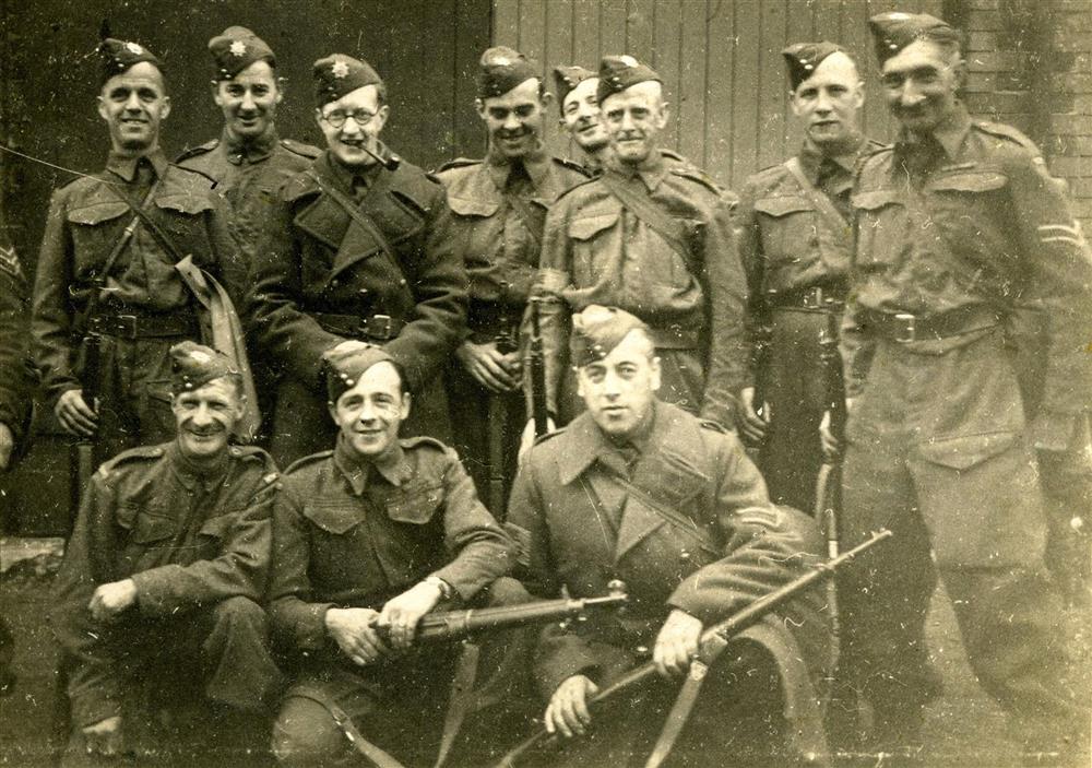
OS Map of the Altrincham area used by the Dunham Massey Home Guard during WWII (1924 reprinted in the early 1940s)
Laminated map mounted on linen, folded into a stiff cloth cover. The map dates from 1924. Scale….

Street Plan of Altrincham and District (1948)
Fold-out map printed by Samuel Butler, Altrincham and published in the Altrincham Official Guide, 1948, for the Altrincham Board of Trade. Scale 6 inches to one Statute Mile.
The laying out of new streets and building of new houses in the 1920s and 30s had stalled during World War II. Due to the ongoing shortage of materials and government bureaucracy after the War, it wouldn’t be until the 1950s that it would all start again in earnest.

Town Map 8: Sale-Altrincham-Hale-Bowdon. County Palatine of Chester Development Plan for the Administrative County (1958)
Kenneth O. Male, County Planning Officer, County Hall, Chester based upon the OS map. Approved by the H. J. Ryan, Assistant Secretary, Minister of Housing and Local Government, 29 December 1958. Scale 6 inches to one mile.
The colour coded Plan shows land use, type of roads and boundaries, at a time when the whole area including Altrincham, came under Cheshire County Council.

Town Map 8 Amendment Map: Sale-Altrincham-Hale-Bowdon. County Palatine of Chester Development Plan for the Administrative County (1961)
Kenneth O. Male, County Planning Officer, County Hall, Chester based upon the OS map of 1961. Scale 6 inches to one mile.
The newly created part of the North Cheshire Green Belt is indicated by green hatched lines, at a time when the whole area including Altrincham, came under Cheshire County Council. The Green Belt was intended to control urban sprawl and strip road development, by providing a protected ring of open land for agricultural, leisure and forestry use.

OS Map covering Dunham Massey, Altrincham, Hale, Ashley, Mobberley, Tatton, Mere, Bowdon, Rostherne, Millington, Agden, Bollington and Warburton,(1951, reprinted with new major roads in 1964)
Sheet SJ78, compiled from 6 inch sheets last fully revised 1904-37; partial systematic revision 1934-39; published 1951 and major roads revised 1963. One kilometre grids.
Part of the stretch of the M6 motorway between Junctions 19 to 20 was opened in November 1963 and can be seen in the southwest corner of the map. The M56 opened in January 1972 (Junctions 1 to 7) and December 1974 (Junctions 7 to 9), were not yet built.

Burrows Pointer Guide Map of Altrincham (1964)
Ed. J. Burrows & Co Ltd, Cheltenham and London, published by the Authority of the Borough of Altrincham. With kind permission of Burrows Communications.
By 1964, the amount of housing and traffic had increased greatly, due to the ongoing demand to live or work in the area, with the same attractions as those in the 19th century: transport, schooling, shopping, the market, leisure and the nearby countryside and fresh air.


Altrincham Town Centre Appraisal Map (1967)
From the booklet Altrincham: A Policy for the redevelopment, improvement and conservation of the town centre, June 1968 (1968), by Kenneth O. Male, County Planning Officer, Cheshire County Council, Chester.
This consultation booklet laid out the County Council’s modern vision for the town, which included the demolition of the 1879 Market House. This was fortunately never undertaken, as in its new guise as an award winning eating, drinking, retail and socialising venue next to a revitalised market, the building has now become the focus for the regeneration of the historic town centre.


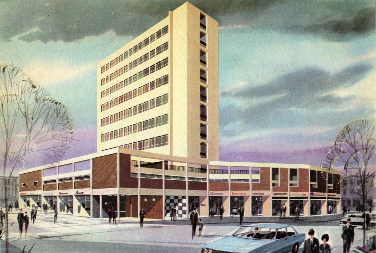
Altrincham Central Area Proposals Diagrammatic Presentation (about 1967)
From the brochure The Graftons, Altrincham (about 1967). Developer Central and District Properties Ltd, London.
The demolition of a group of low rise Victorian buildings at the corner of Regent Road, to build new retail units and a high rise office block was seen as first stage of the redevelopment of the town centre. Proposals included a ring road encircling most of the town, with the centre including the Old Market Place to be made a pedestrian zone.

The Altrincham Circular: 11 Discovery Trails, Altrincham W. E. A., 1989
DOWNLOAD searchable PDF (12.5 MB)
Designed for the “curious explorer”, the guide describes a 17-mile circuit of Altrincham divided into easy sections, passing through areas as diverse as Broadheath and the Bollin valley. Some of the route will have changed considerably, while other parts remain much the same.

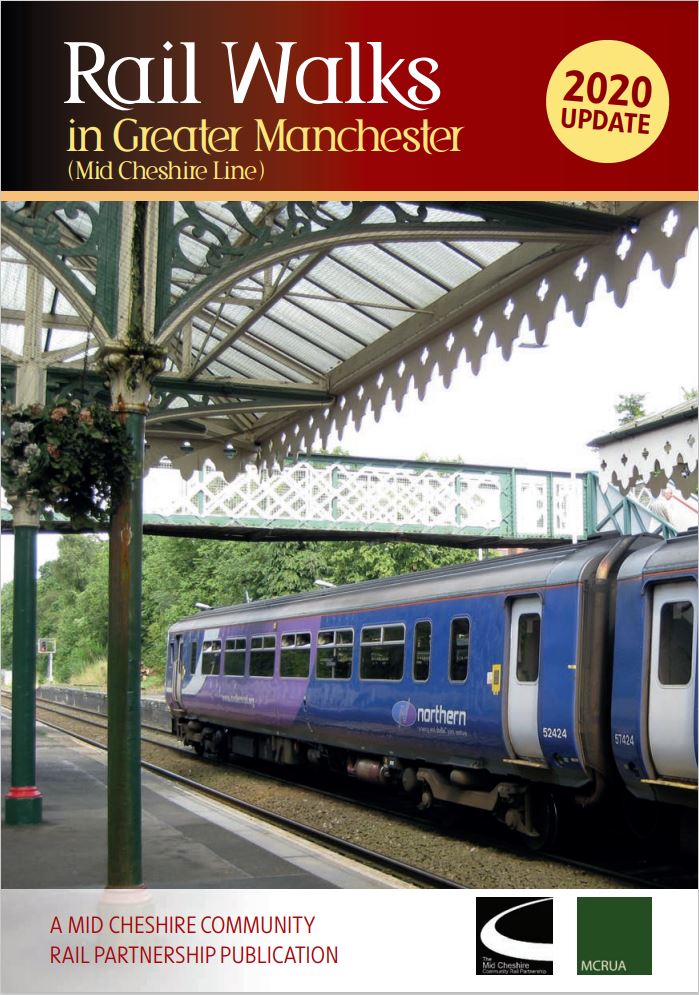

Rail Walks in Greater Manchester (Mid Cheshire Line), 2020 update
A Mid-Cheshire Community Partnership publication in conjunction with Mid Cheshire Rail Users Association (MCRUA).
DOWNLOAD searchable PDF (4.1 MB)
Provides map routes, illustrations and descriptions of the many varied and attractive walks from stations along the Greater Manchester section of the Mid Cheshire Line.